↓
 

Huntsville Civil Engineering

Huntsville Civil Engineering
  • Home
  • Civil Engineering
  • Construction Management
  • Drone LiDAR Mapping
  • Land Development Services
  • Structural Engineering
  • Transportation Engineering
  • Contact Us
Home 1 2 3 4 5 >>

Post navigation

← Older posts

Welcome to Huntsville Civil Engineering

Huntsville Civil Engineering Posted on October 28, 2016 by HuntsvilleEngineerJanuary 2, 2026

Civil Engineers in Huntsville, AL

Welcome to Huntsville Civil Engineering. This is the marketing website for Pro17 Engineering, LLC, which is owned and managed by J. Keith Maxwell, Professional Engineer and Land Surveyor.

J. Keith Maxwell, PE, PLS

Professional engineer Huntsville -  J. Keith Maxwell, PE, PLS - Huntsville Civil Engineer

Keith is a graduate of Auburn University (BSCE 1987, MCE 1991) and has been in the consulting business since 1989. Most of that time was spent in Auburn where he was a part of numerous land development projects over the years in the “Loveliest Village on the Plains.” Keith also taught as an adjunct professor in both the Civil Engineering and Building Science departments.

Keith moved his consulting practice to the “Rocket City” in mid-2015 and has hit the ground running. He has completed many land surveying projects and is currently working on multiple engineering designs for projects around the state.We cover the entire Greater Huntsville area, which includes Madison County, Limestone County, the City of Huntsville, and the City of Madison.

If you need an experienced and professional engineer and/or land surveyor on your land development team, give us a call at (256) 617-5010/

Posted in Civil Engineering | Tagged civil engineer, huntsville civil engineering, j keith maxwell

Traffic Engineer Planning Near Bypass Projects

Huntsville Civil Engineering Posted on July 16, 2026 by HuntsvilleEngineerJuly 14, 2026
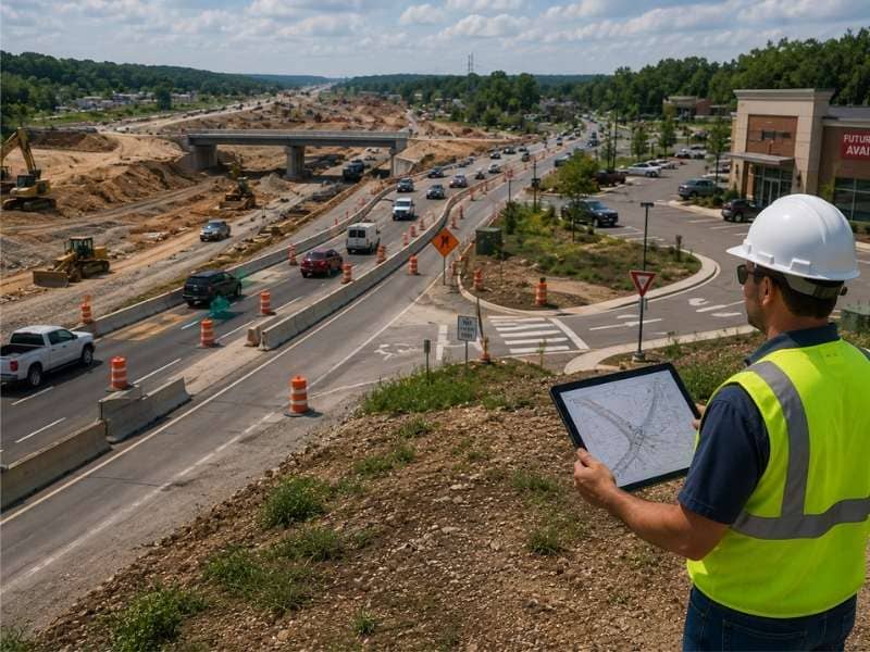
Traffic engineer reviewing property access, temporary traffic patterns, and future roadway conditions near a bypass construction project.

A new bypass rearranges the map. Roads that carried steady traffic for years suddenly go quiet. Quiet roads pick up traffic no one planned for, and properties along those roads wake up to a whole new scene at the driveway. A traffic engineer evaluates how new road projects affect property access, turning movements, and future traffic patterns before construction begins through transportation planning. The numbers a property counted on before the project may not hold. Owners who plan around the change tend to come out ahead. Owners who assume things stay the same usually do not.

Evaluating Access Changes Created by New Road Projects

Big road work reshapes access in ways that catch owners off guard. A new median removes a left turn a business relied on for years. A raised curb wipes out a second driveway. Land gets taken for the road, and an entrance that fit fine before now sits too close to a new intersection.

An engineer reads the project plans early and traces those effects onto the property. Through transportation planning, the engineer evaluates which turns stay, which ones go, and what the site needs to work once the new layout opens.

Planning Safe Property Access During Roadway Expansion

Construction makes a strange world of its own, and it can last for years. Lanes shift. Detours reroute normal traffic. Access to a property may run through a gravel path or a narrow opening for months at a time. Customers and delivery drivers make choices based on how hard all of that feels.

Engineers plan for that time instead of waiting it out. Temporary paths need enough width and clear sight lines to stay safe as things change. Traffic inside the site may need reworking so cars do not stack up at a tight entrance. Checking the road contractor’s schedule shows when access will be worst. That lets an owner get ready instead of react. Sites that stay easy to reach keep their business. Sites that turn into a hassle lose customers who do not always come back once the road opens.

Anticipating Future Traffic Demand Around Growth Corridors

Bypasses draw development, and development draws traffic. Land that sat idle for thirty years turns attractive the moment a new interchange opens nearby. And the road that feels fine during construction can fill up within a few years of the finish.

Traffic engineers build that in from the start. They use area growth plans and approved projects to guess what the road will carry later. Designing an entrance for the road’s future, not just today, avoids a nasty surprise. Otherwise a driveway approved this year fails three years from now. Turn lane length, driveway spacing, and inside queuing all need that longer view. Fixing them later means rebuilding under live traffic.

Coordinating Site Development With Transportation Improvements

Private building and public road work run on separate clocks, and the two rarely line up on their own. A site that opens before the road finishes may need a temporary entrance and then a permanent one. A site that waits may sit idle a year longer than the owner planned.

Coordination helps both sides. Sharing plans early lets the road designer plan for the driveway. It lets the site designer match grades at the new pavement edge. It also settles who builds what, since the entrance often falls in a gray zone between the two projects. Timing matters most of all. Permits for work in the road area move slowly while a road project is active. An owner who applies late waits behind everyone else.

Supporting Development Approvals With Traffic Engineering Analysis

Agencies reviewing a project near active road work face a harder question than usual. They are judging a site against conditions that do not fully exist yet. A traffic study that models the road after the project opens gives them something solid to work from.

That study usually shows how much traffic the project makes. It shows how that traffic spreads across the changed roads. It shows what the key intersections do under future volumes. And it shows what the site needs at its entrance to keep things running. Reviewers lean on that work because they must protect a road the public just paid for. Applicants who show up with strong numbers get approved. Applicants who show up with guesses get conditions attached, or get sent back to do the study anyway.

Frequently Asked Questions

When should a traffic engineer become involved in a project near a bypass?

As soon as the road plans go public. Access choices get locked into a road design fairly early. And once construction starts, changing an entrance spot gets hard and costly. Early help leaves time to shape the design, or to plan the site around what the design already sets.

How does a traffic engineer improve access planning?

By working from the road outward, not the building outward. The engineer looks at what the road will be like once construction ends. They see which turns the design allows and where an entrance can safely go. Then they shape the site to fit those limits instead of fighting them.

Can traffic engineering help reduce future congestion around new developments?

It can, though it works best used across a whole area. Well-spaced driveways, turn lanes that pull slowing cars out of the through lane, and inside layouts that keep lines off the road each cut the friction a project adds. The effect grows when a whole corridor follows those rules. It fades when only one site does.

Posted in Transportation Engineering | Tagged Transportation Engineering

Drainage Design for Greenway-Focused Development

Huntsville Civil Engineering Posted on July 15, 2026 by HuntsvilleEngineerJuly 14, 2026
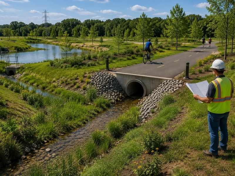
Drainage design along a greenway showing a dry recreational trail, vegetated swale, culvert crossing, and stormwater basin.

Trails and stormwater end up fighting for the same low ground. That is why drainage design needs attention early in any project with a greenway. Water collects in the flat, shaded strips people most want to walk through. Ignore that, and you get a path that floods every spring. You get a pipe that dumps right across a trail. And you get a crew that dreads the whole corridor. Done well, the same system fades into the background, and the greenway just works.

Integrating Drainage Design With Recreational Corridors

Trails and drainage can share space when someone plans for it. Swales run beside a path instead of through it. Culverts carry flow under the trail at crossings. They are sized to keep the surface dry during the storms that really happen. Trail grades tilt a little, so rain runs sideways off the path instead of down its length.

Placement drives the result more than anything else. A trail set a foot or two above the low ground stays usable in wet weather. The same trail built in the swale bottom becomes a channel. Designers who study the land before setting the path avoid that mistake. And the extra thought costs almost nothing at the design stage.

Managing Runoff Around Natural Open Spaces

Runoff needs a route, and open space often gives the clearest one. That does not make it the right one. Fast, tight flow across a meadow or woods cuts gullies, strips soil, and dumps sediment into whatever sits downstream.

Better designs spread water out before it reaches soft ground. They slow it down before it can do damage. Level spreaders, plant buffers, and gentle grades turn a fast, tight flow into a slow sheet the ground can soak up. Where a real channel is needed, armor the inlet and outlet. That keeps erosion from spreading up and down the corridor. Playing fields, picnic areas, and other spots where people gather stay usable when the design routes water around them, not through them.

Designing Drainage That Supports Long-Term Maintenance

Stormwater management only works while someone maintains them. And maintenance leans hard on access. A structure a crew cannot reach with a truck rarely gets cleaned. That one fact should shape design choices more than it usually does.

Smart design keeps maintenance in mind from the start:

  • inlets and outlets a crew can reach without heavy gear or a long walk
  • basin side slopes flat enough to mow in a safe way
  • sediment traps that gather debris in one place instead of spreading it around
  • clear access routes wide enough for the gear the work really needs
  • structures marked and written down so the crew knows what is there and where

Systems built this way get cleaned on time. Systems built without that thought slowly clog. The first sign of trouble is standing water where no one expected it.

Protecting Adjacent Properties From Changing Drainage Patterns

Development changes where water goes, and neighbors notice. Roofs, pavement, and packed ground send far more runoff downhill than an open field ever did. Sending that extra water across a property line invites complaints and lawsuits alike.

Good design holds the site in charge of its own water. Detention and retention slow the release, so downstream flow stays close to what it was before. Grading keeps runoff inside the site instead of pushing it onto a neighbor’s yard. Old flow paths that cross the land stay open, since blocking them backs water up onto whoever sits upstream. Getting this right is partly a legal question. But it is mostly about not making a problem for someone who had no say in the project.

Planning Drainage Systems Along Expanding Development Areas

Development rarely stops with phase one. Pipes and basins sized for only today’s footprint force a rebuild the moment someone adds a parking lot or extends the trail. And rebuilding a drainage system under a finished site costs far more than sizing it right at the start.

Forward-looking design leaves capacity in reserve. A basin with room for future runoff. A main line sized for a larger area. An outfall that can take another connection later. Planning around future features helps too, since a new trail or a future park changes where water can go. Owners who look one phase ahead usually find the extra cost small. It beats tearing out a working system just to make it bigger.

Frequently Asked Questions

Why is drainage design important for developments near greenways?

Greenways sit on the low, flat ground where water naturally travels. That puts trails and stormwater in direct competition for the same space. A design that ignores this makes flooded paths, eroded banks, and shorter trail seasons. Planning the two together keeps the corridor usable and keeps the drainage system doing its job.

What factors influence a successful drainage design?

The shape of the land, how fast the soil soaks up water, how much hard surface a project adds, rainfall patterns, local stormwater rules, and how much water arrives from upstream. Access for maintenance belongs on that list too. An unreachable system stops working within a few years, no matter how well it was planned.

Can drainage design reduce future maintenance costs?

Yes, and the savings are steady rather than sudden. Basins with mowable slopes, structures a crew can reach, and traps that catch sediment in one spot all cut the labor a system needs each year. Hard-to-reach structures get skipped. And skipped maintenance turns into emergency repair, which is where the real money goes.

Posted in Civil Engineering | Tagged civil engineer

Site Plan Review Steps That Support Approvals

Huntsville Civil Engineering Posted on July 14, 2026 by HuntsvilleEngineerJuly 14, 2026
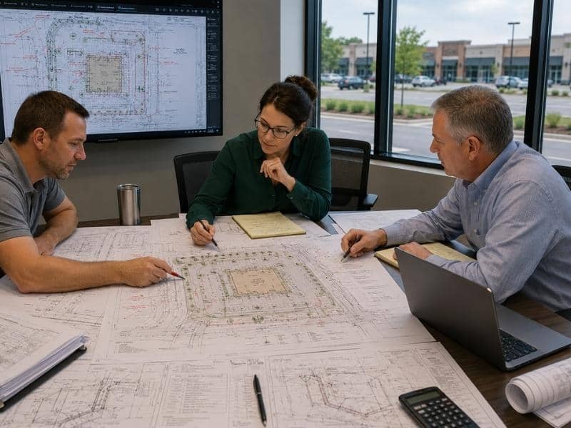
Site plan review meeting with engineers and project reviewers coordinating building placement, parking, drainage, utilities, and access for approval.

Few things test an owner’s patience like waiting on a site plan. The review process has a name for being slow. Part of that name is earned. The rest comes from people who send in weak drawings and then blame the agency for the delay. Reviewers work from a set list of things they expect to see. A plan that meets that list moves much faster than one that does not. The gap shows up months before anyone reaches the counter.

Preparing a Site Plan That Meets Review Expectations

Reviewers open a plan looking for certain things. Where the building sits. How far it stands from each property line. How cars come in and move around. How many parking spaces the use needs. Where water goes. How the site ties into public utilities. What plants the code calls for. A drawing that answers all of that in a clear way earns a fair reading.

Looks matter more than most people expect. Clear text, the right scale, a north arrow, and a clean legend sound like small things. But a reviewer working through a tall stack notices them right away. A messy drawing hints at messy design. That first thought colors every comment that comes after.

Coordinating Technical Disciplines Before Submission

A site plan pulls from many hands at once. The surveyor shows what is already there. The architect sets the building shape. The civil engineer handles grading, drainage, and utilities. The landscape designer fills the space between. All of these parts must agree before anything is sent in.

Conflicts hide in the seams. A power pad drawn where the plan shows a tree. A storm line running through a planned foundation. A parking count that changed when the building grew, but no one fixed the total. Reviewers spot these clashes fast and send the whole set back. A check between teams takes a week in house. The same clash found by an agency costs a full review cycle.

Responding Efficiently to Review Comments

Comments come on almost every project. Getting them says nothing about the quality of the work. How an applicant answers them says a lot. The smart way treats each comment as a question that needs a clear answer. Fix it on the drawing. Then confirm it in a short written reply that points to where the change is.

Trouble starts when applicants argue instead of fix. Or when they fix four comments out of six and hope no one checks. Reviewers always check. A partial answer buys another round, and each round burns weeks. If you disagree with a comment, call and talk it through. That works far better than sending the same plan back unchanged.

Balancing Site Function With Regulatory Requirements

Codes give minimums. A plan built to just those minimums often works poorly in real life. An aisle wide enough for the rule can still trap a delivery truck. A dumpster tucked in the legal corner can force the hauler to back across the whole lot.

Good design meets the rule and the daily reality at once. Where the two pull apart, you have choices. Change the layout. Ask for a waiver with a solid reason. Or accept a tradeoff on purpose, not by accident. The plans that age well are the ones where someone asked how the site would really work on a plain Tuesday. Then they designed around the answer.

Maintaining Project Momentum After Site Plan Approval

Approval is a checkpoint, not a finish line. The approved plan then grows into build documents that guide the next phase of site development. Separate permits follow for grading, utility hookups, and stormwater work. Each one has its own review process and timeline.

Conditions tied to the approval need tracking too. Agencies often want an easement, a fee, or a bond before work starts. Missing one of those can quietly stall a project everyone thought was cleared. Owners who put someone in charge of that list keep moving. Owners who assume approval settled it all often find out otherwise at the worst time.

Frequently Asked Questions

What information should be included in a site plan?

Building placement with setback sizes, parking layout and counts, entry points and inside traffic flow, grading and drainage, utility hookups, landscaping, lighting, and what is already on the site. Rules change by place and by project type, so the local checklist rules. Anything a reviewer has to hunt for turns into a comment.

Why do agencies request revisions during a site plan review?

Usually because something is missing, unclear, or does not match between sheets. Reviewers check the plan against the code and against itself. Any gap becomes a written comment. Some changes point to a real design conflict. But a large share come from facts the applicant just never gave.

How can a complete site plan help speed up project approvals?

A complete plan removes the reason for extra rounds. A reviewer who finds every needed item can approve or comment for real on the first pass. They do not have to send the set back for basic gaps. Since each cycle often adds several weeks, cutting even one round makes the schedule much shorter.

Posted in Civil Engineering | Tagged civil engineer

Post navigation

← Older posts

CONTACT US


© Copyright 2018 Pro17 Engineering, LLC
244 Kyser Boulevard #404
Madison, Alabama 35758
Phone: (256) 617-5010

Privacy Policy | Terms of Use

Web Development and SEO by:
SEO Company for Professionals

The owner of this website, USA Surveying & Engineering, LLC., provides coordination of professional land surveying and engineering services in all 50 states. The professional surveying and engineering services provided to you will be conducted by fully licensed professionals in your state.

↑